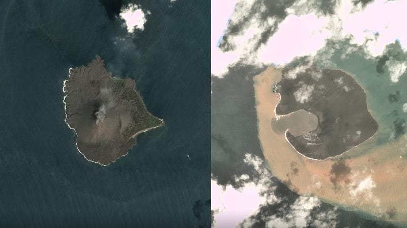
 Left: Anak Krakatau on December 17, 2018, before the landslide. Right: The island volcano on December 30, 2018, after the landslide.
Vivid new satellite photos of Anak Krakatau are providing our first cloud-free glimpse of the island volcano that triggered a devastating tsunami in Indonesia late last month. As the photos show, a gaping lagoon now appears where a 1,115-foot-high volcanic mountain once stood.
It’s now all but certain that a devastating landslide on Anak Krakatau unleashed the Indonesian tsunami on December 22, 2018, an event that killed over 420 people and displaced thousands along the coast of Java and Sumatra.
Before-and-After Pics Show Dramatic Collapse of Tsunami-Causing Volcano in Indonesia
The entire southwest flank of Indonesia’s Anak Krakatau volcano is missing, as new radar imagery…
Read more Read
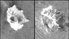
In the days that followed, poor weather and incessant cloud cover over the region prevented satellites from capturing a clear view of the island volcano. Grainy radar images released on December 27 were the first to provide visual evidence of the collapse, but new images released today by Planet Labs, a private Earth-imaging company based in San Francisco, show Anak Krakatau both before and after the landslide, in exquisite detail. Planet Labs captured the images using its Dove and SkySat platforms, as BBC reports.
An image taken on December 17, 2018 shows the volcano just five days before the collapse. Other than a plume of smoke rising from the top of its cone, nothing seems out of the ordinary.
A shocking image taken on December 30—a week after the disaster—shows the shattered remains of the island volcano. Every edge and contour of the island is now different, its shape irrevocably changed. A gaping lagoon—now a bay—appears where the mountain once stood. Foliage that once grew along the island’s eastern regions appears to be completely gone. A copious amount of light brown sediment can be seen wafting in the waters along the island’s western and southern coasts.
Anak Krakatau on January 2, 2019.Image: Planet Labs
A satellite photo captured just yesterday, on January 2, offers a closer view of the island. Thick white smoke can be seen billowing from the volcano’s new cone, while no shred of vegetation can be seen on the island’s surface. The new bay appears to have shrunk since December 30, suggesting ongoing seismic activity and land slips as the volcano continues to rumble and settle.
Writing at the Landslide Blog, geologist David Petley said the new images show that a significant portion of the landslide came from above sea level (a subaerial landslide), contrary to initial reports that it was a submarine landslide.
“No remains of the landslide are seen—it left almost nothing behind as far as I can see—so the entire volume of 150-170 million cubic metres entered the water,” wrote Petley. “It is unsurprising therefore that it generated a very significant tsunami in the local area.”
What’s more, Petley said the toe, or base, of the landslide was “extremely broad,” which meant the landslide “would have been able to displace water across a very large front.”
Looking at these photos, Anak Krakatau appears to be one of the most formidable and uninviting places on Earth at the moment. And as the smoke billowing from its surface suggests, it continues to be an active volcano. Residents along the Sumatra and Java coast are being told to stay on high alert for fear of further tsunamis.
[BBC, The Landslide Blog]
Share This Story