The idea of creating a satellite navigation system was born in the 50-ies of the last century. American scientists led by Richard Kershner watched the signal coming from the Soviet satellite, and found that due to the Doppler effect the frequency of the received signal increases with the approach of the satellite and decreases with its distance. Thus, just knowing your coordinates on Earth, you can measure the position and velocity of the satellite, and Vice versa, knowing the position of the satellite, it is possible to define own speed and coordinates.
The first steps in creating a GPS was taken by the Americans in 1964 with the launch of satellites under the program of Timation into orbit. Initially, GPS was conceived as a military technology, but in the process the system decided to use for civilian purposes. For this purpose a special algorithm was a reduced precision. Soviet scientists began work on a Russian system, GLONASS, in 76 year. Originally she also had a military purpose.
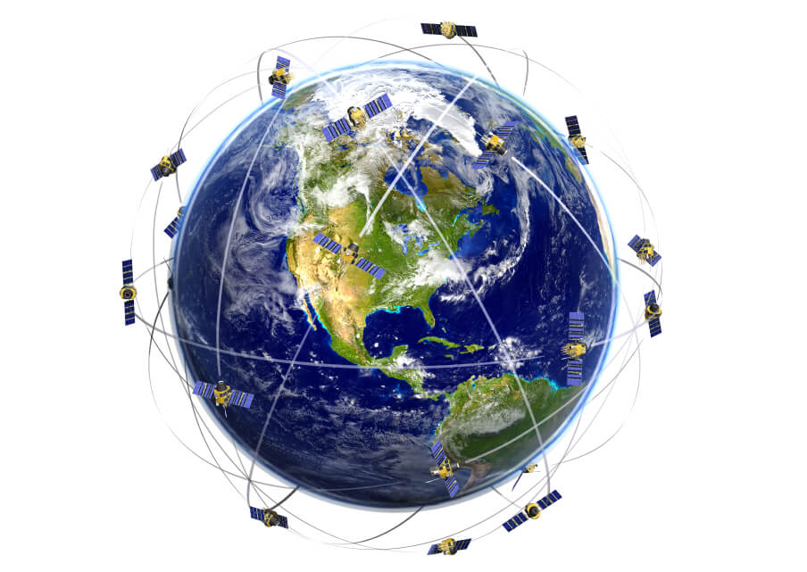
The navigation system consists of three major segments: space, control and user. Space is represented by 32 satellites from the GPS and the 28-th GLONASS rotating medium Earth orbit. The control segment consists of several monitoring stations and ground antennas, correction information about the location of objects. The satellites broadcast signals from space, and all receivers use this signal to calculate its position in space by coordinates in real time. To do this, the receiver must receive a signal from at least three (and preferably four) satellites.
GPS satellites revolve around the Earth in 6 circular orbital paths with 4 satellites each at an altitude of 20 180 km For a star the day they make two complete orbits around the Earth. GLONASS satellites orbit unlike the GPS is located at a height of 19 400 km for a more accurate use in the Northern and southern polar regions.
The satellites continuously send a signal to the entire available surface of the planet with information about his location and time on its own clock. They do not accept data of any devices receivers. The receiver receives the coordinates of the satellites and information about time sending signals and calculates the distance to each satellite. This is done by a program by multiplying the speed of light to the difference between the time of receipt and time of sending of the signal.
The task is complicated by the fact that the time on the clock of the receiving device does not match with what clock of the satellites. In addition, satellites are susceptible to effects of relativistic and gravitational time distortion. At an altitude of 20,000 kilometers gravity is weak and the satellites are moving at high speed. Because of these effects of the clock have been adjusted by 38 milliseconds per day. If this is not done, the error in determining coordinates on the Earth may be about 10 km!
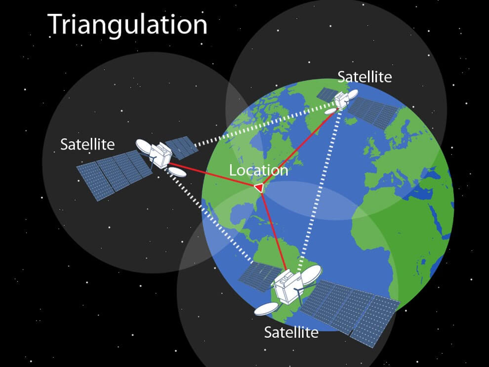
Calculating the distance to each of three or four satellites, the receiver analyzes the data and determines their exact location.
Drawbacks of navigation systems is that under certain conditions the signal from the satellites may not reach the receiver: for example, in a basement or tunnel. Also, the reception level may deteriorate due to heavy clouds, and magnetic storms.
How does it work? | Satellite navigation system
Hi-News.ru